
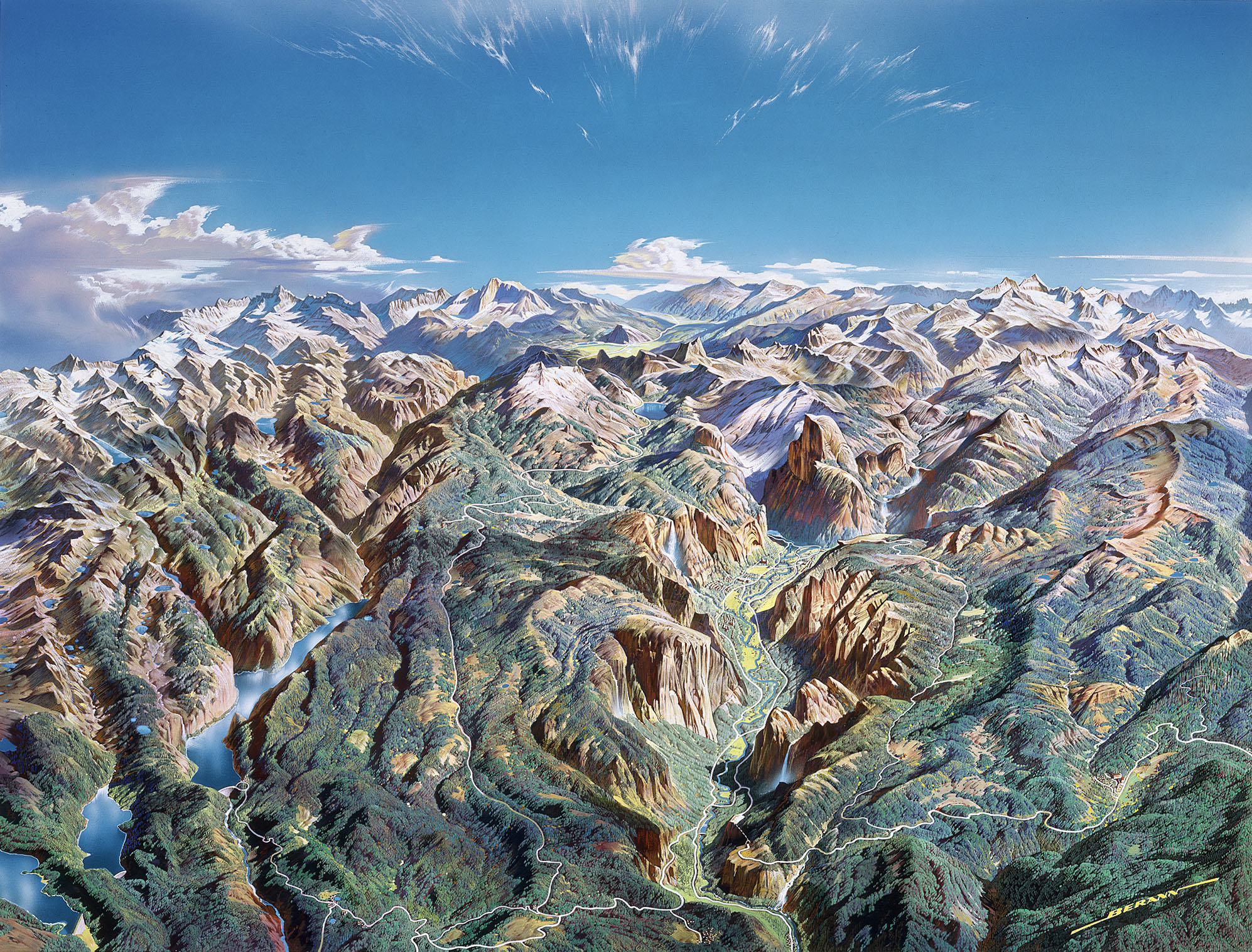
One of the most common types of reference map is topographic with contours that represent changes in elevation. It is actually quite easy to produce this kind of a map using GIS programs such as ESRI ArcMap. All one needs is a Digital Elevation Model (DEM) of a landscape and within a few clicks you can have a decent looking model of the terrain. Generally, a pure USGS topo map just shows the elevation with the use of the contours set at intervals, and some simple symbolization for ground cover, such as green areas for forest. This exercise incorporates shaded relief, hypsometric tints, and contour lines to display the landscape in a more realistic fashion. Since we can, why not have the best of all worlds? The tutorial for this entire process can be downloaded here, and a great data source for the data is the GeoCommunity website. Also, after working on this, I found it easier to locate a given quadrangle at the USGS Map Locator website. So experiment with the techniques and the next time you go hiking, impress the partners with your own custom topographic masterpiece!
Sunday, April 11, 2010
Subscribe to:
Post Comments (Atom)
Thank you! This is just the refresher I needed.
ReplyDeleteThank you very much! How simple it can be to create a Shaded Relief map without Surfer!
ReplyDeleteYour video was a great refresher on making contours. Thank you.
Delete