

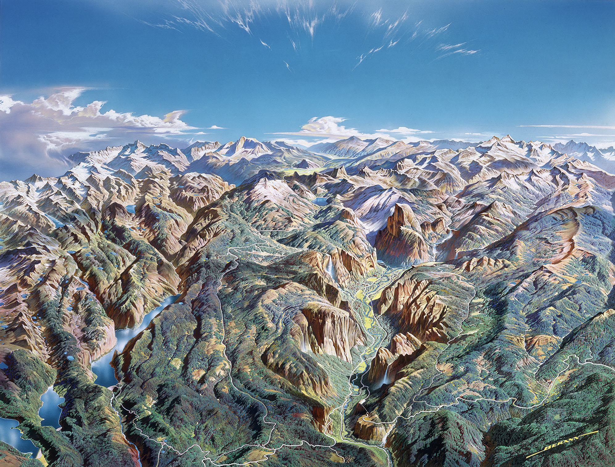
The iconic Swiss cartographer, Eduard Imhof felt that the base of almost all maps was the relief representation. He further remarked that the “proper rendering of relief is one of the primary tasks in cartography” (Imhof 1982). In the modern digital workflow, rendering relief is as simple as clicking the mouse a few times. But is it “proper,” as professor Imhof would say? With high resolution data, stock relief shading tends to be a complex cacophony of overly detailed valleys and ridges. Like all of cartography, a little generalization can be good. With relief, the ideal would be to highlight the most important features in the landscape, subdue the complex terrain, and brighten the darkest recesses were detail is lost in shadow. The ESRI Mapping Center provides a free Swiss Hillshade model that simulates hand painted relief in a digital workflow. It’s not perfect, but is a great place to start! I have also modified it a little to meet my needs and you can download my version here. The video will get you started on technique, buts it’s well worth grounding yourself in theory on this excellent site. Happy mapping!
good blog dude
ReplyDeleteA really nice blog :) have you thought about about using the profile in ArcMap to create physical Raised Relief Maps like the one in the link? I don't think it would be too difficult and if you could link ArcMap to some CAM software, then it will do it for you.
ReplyDelete